Geography 353 Cartography and Visualization
...to Geog 353 Main Page and Course Description
...to Geog 353 Syllabus
...to Geog 353 Course Schedule and Lecture Outlines
...to Geog 353 Laboratory Information and Student Projects
Geog 353 Lecture Outline: What is a map?
Update: 7/8/19
Introduction
1. What is a Map?
Map: 321 Definitions
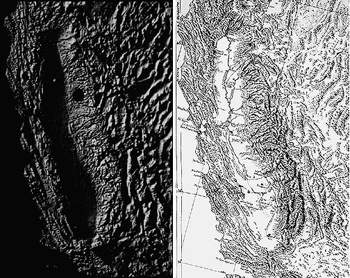
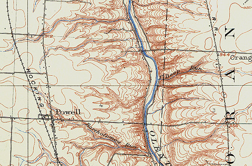
Map: a "spatial representation of reality"
- spatial: consisting of at least two dimensions and usually referring to
geographic space
- representation: something that stands for something else (in our case,
something in the human or physical environment)
- reality "the state of things as they actually exist."
Map: "A graphic statement that locates facts."
- Graphic: A visual display of marks which stand for something else.
An airplane shape on a map implies an airport.
- Statement: To put forth information, a formal embodiment of facts or
assertions.
- Locating facts: Tangible and intangible phenomena located in geographic
space: what we can see (roads, rivers) and what we cannot see (temperature,
radiation), varying in amount (population) and kind (vegetation types).
- But: "My show shoes are in my basement": is this a map?
Map: "Maps are Propositions."
- What is a proposition?
- the act of offering or suggesting something to be considered, accepted, adopted, or done.
- a plan or scheme proposed.
- a thing, matter, or person considered as something to be dealt with or encountered: Keeping diplomatic channels open is a serious proposition.
- anything stated or affirmed for discussion or illustration.
- a proposal of usually illicit sexual relations.
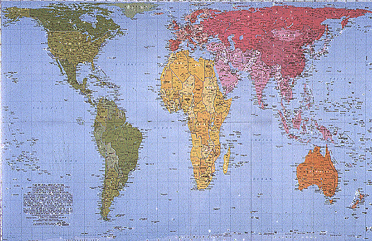
- Handout: Ce n'est pas le monde
So what is a map? Which one of the definitions is most appealing?
Some more jargon...
Mapmaking: the production of a tangible map; the aggregate of those individual
and largely technical processes of data collection, cartographic design and
construction, reproduction, normally associated with the actual production of
maps; designing, compiling, and producing maps."
Cartography: seen as broader than map making, as it involves the theoretical
and philosophical aspects of mapmaking rules.
- International Cartographic Association (ICA): Cartography is "the art, science,
and technology of making maps, together with their study as scientific documents
and works of art. In this context may be regarded as including all types of
maps, plans, charts, and sections, 3D models and globes representing the Earth or
any celestial body at any scale.
Visualization: The interactive use of digital maps to explore and
understand data. Geographic Visualization refers to the visualization of
spatially distributed (geographic) data, and usually involves maps. Visualization
usually means more exploratory, preliminary examination of data with maps
to try and learn things about the data (and the phenomena the data represents).
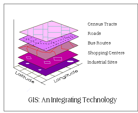
Geographic Information Systems: Computer hardware and software for the
capture, storage, retrieval, analysis, and output (paper or digital display) of
spatial data. Maps play a vital role in the analysis (visualization) and display
components of GIS.
Geographic Cartography: Geographic cartographers understand the techniques
for mapmaking and the context of what they are mapping.
- Richard Hartshorne from The Nature of Geography: "So important, indeed, is the
use of maps in geographic work, that, ... if (the) problem cannot be studied
fundamentally by maps - usually by a comparison of several maps - then it is
questionable whether or not it is within the field of geography." (Hartshorne
1939).
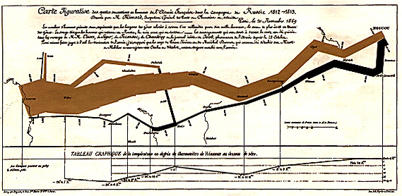
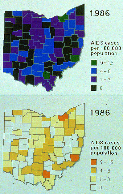
2. What Maps Do to the World: Cartographic Abstraction
Cartographic abstraction: transformation of unmapped data into map form and
selection and organization of information to help user interpret material;
identification of what is relevant given the purpose of the map
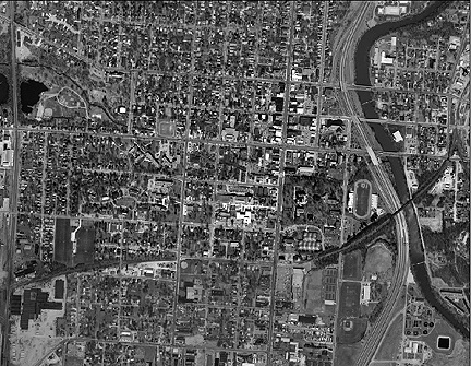
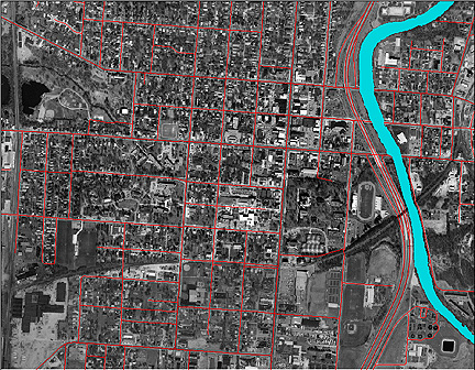
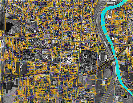
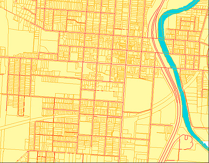
Selection: geographic space to be mapped, map scale, projection, aspect, data
variables, data gathering or sampling, client needs, familiarization with what is
to be mapped (you have to know about what you are mapping)... but mostly, what is
chosen to be mapped... and what is not mapped.
Classification: grouping and categorizing; reduction of complexity to organize
the mapped information to enhance communication
Symbolization: marks which represent data in some logical way
Design: "The planning and patterning of any act towards a desired foreseeable
end constitutes a design process" An act of synthesis: pulling together
disparate elements into something coherent
3. What is Map Design? an Art and a Science?
Truism: cartography is an art and a science
- Borden Dent: "The art in cartography is the cartographers ability to synthesize the
various ingredients involved in the abstraction process into an organized whole
that facilitates the communication of ideas."
- Krygier "Cartography as an Art and a Science?"
The "art of cartography" works in tandem with rules, guidelines, and the elements of "cartographic
science" which are much more tangible.
Both art and science are necessary in order to create effective maps
Cartography and Art...
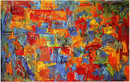
People do have aesthetic reactions to maps: maps as objects of interest,
contemplation, and interest beyond their immediate utility
J. S. Keates: British cartographer: aesthetic responses to maps
- imitation: somehow the map reminds us of what it represents in a way that makes
us appreciate it. We like maps because they seem mimetic and even better than
the reality they are supposed to represent
- Emotive: somehow the map causes some emotional reaction
- Expressionist: somehow the map causes us to feel that there is some personal
expression from the map maker - some distinguishing characteristics that make us
associate the map "look" with a certain person or persons

- communicative: while put together bit by bit, a map seems to have some
"message" that is more than the sum of its parts: emergent properties.
- formalist: the least applicable to maps, according to Keates. A response to
the work itself which is not dependent upon the object the work represents, but
on the abstract form of the work
- How can we harness these characteristics to make our own maps more powerful?
Cartography and Science...
Science defined: a methodological and objective process by which we come to
understand physical and human phenomena
- Arthur Robinson and the OSS (Office of Strategic Services) during WW2: question: how do
people react to different map designs? Is there a way to systematically and
formally improve the design of maps?
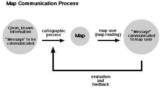
- Origins of the Communication model...
- Ideas from communication science and perceptual and cognitive psychology
- The "scientific approach" to map design had useful results: a coherent body of
map design principals and guidelines which provide a starting point in the map
design process
- Much of this is based on perceptual research: evaluation of human visual
processing of the visual variables and determination of their visual limits
Map making: combine the principals and guidelines derived from scientific
approaches to map design with the aesthetic aspects of design and mapping
4. Ethics: Responsible Map Making | Right Map Making
Responsible Map Making
Right Map Making
- PDF) Making Maps
- What do you think?
E-mail: jbkrygier@owu.edu
...to Geog 353 Main Page and Course Description
...to krygier teaching page.
...to krygier top page.
OWU Home
OWU Geology and Geography Home