...to Geog 222 Main Page and Course Description
...to Geog 222 Syllabus
...to Geog 222 Course Schedule and Lecture Outlines
...to Geog 222 Exercises
Today: some basics and an overview of general issues about maps and mapping - and all of us as map people.
Maps and Us
...last time...examples...the power of maps.... But what is a map?
Map: one official definition: "a symbolized image of geographic reality,
representing selected features or characteristics, resulting from the creative
efforts of cartographers and designed for use when spatial relationships are of
special relevance" (ICA, 1995)
Map: another definition: a "spatial representation of reality"
Maps simplify the environment; making "reality" easier to understand
Maps show us what we cannot see; what we feel temperature (so maps are synesthetic)
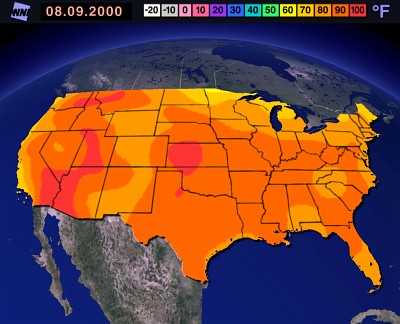
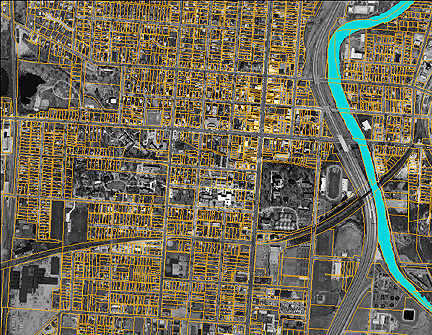
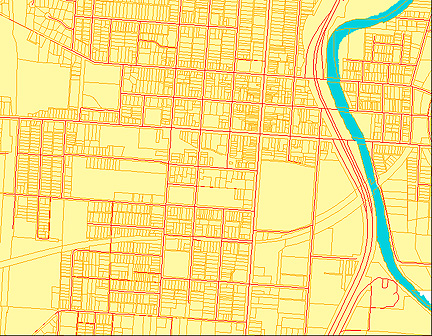
Maps represent a multitude of phenomena: way more than just road maps!
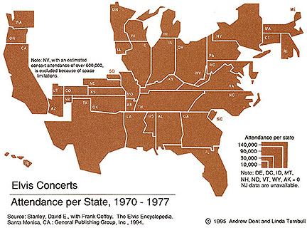
Maps are diverse, and all around us...but there are some problems with maps:
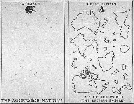
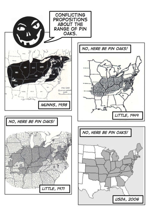
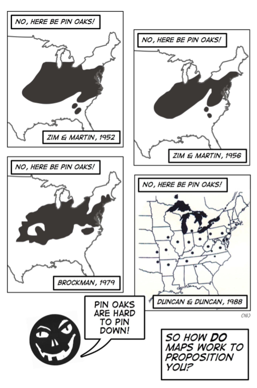
Dorling: a key focus when trying to understand maps is "how the creation and use of maps affects the various ways in which we think of and view the world"
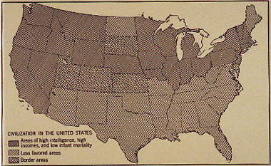
Monmonier: the "paradox" of cartography: to present a useful and truthful picture, an
accurate map must tell white lies"
First step in understanding maps: how do we come to know the environment around us?
Environmental knowledge NOT acquired in a passive manner
Knowing the environment: a simplified process (series of steps)
1a. Sensory Data
Use of sight, sound, smell, taste, and touch all provide us with sensory data
Sound: "Sound is vibrations propagating through a medium such as air. The
detection of these vibrations is a mechanical sense
akin to a sense of touch. In humans, this perception is
executed by tiny hair fibres in the inner ear which detect the motion of a membrane which
vibrates in response to changes in the pressure exerted by atmospheric particles within a
range of 20 to 22000 Hz, with substantial variation between individuals."
(source)
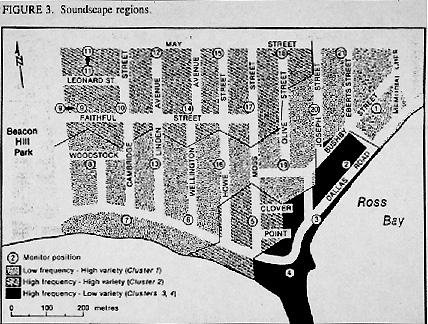
Using soundscapes: Boat Captains off the Coast of Canada:
Mapping Soundscapes in Vancouver BC, Canada
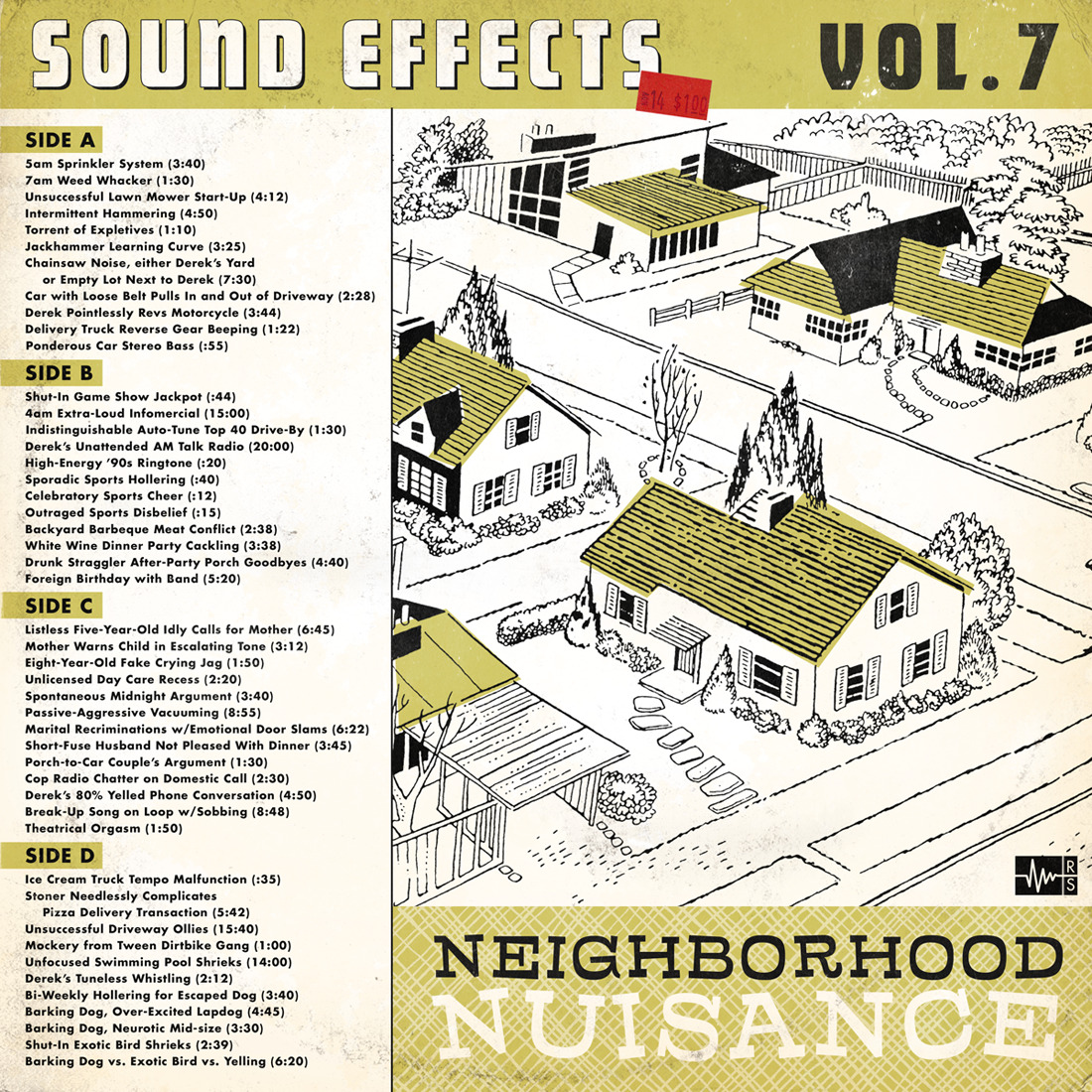
Neighborhood Nuisance
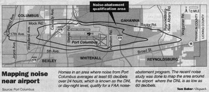
Mapping Soundscapes around the Columbus OH Airport
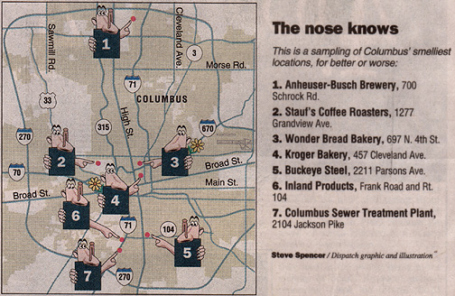
Smell: smell-scape: "Smell is a "chemical" sense (like taste). Unlike
taste, there are hundreds of olfactory receptors, each binding to a particular molecular
feature. Odor molecules possess a variety of features and thus excite specific receptors
more or less strongly. This combination of excitatory signals from different receptors
makes up what we perceive as the molecule's smell."
(source)

Touch: "Touch, also called tactition, mechanoreception or somatic sensation, is the
sense of pressure perception, generally in the skin. There are a variety of nerve endings
that respond to variations in pressure (e.g., firm, brushing, and sustained).
(source)
Taste "Taste or gustation is a chemical sense. There are at least four types of
tastes that "buds" (receptors) on the tongue detect. The four well-known receptors detect
sweet, salt, sour, and bitter." (source)
Even more senses: Balance/acceleration, temperature, kinesthetics (sense of the relative
position of body parts), pain...
Vision: "Sight or vision is the ability of the brain and eye to detect
electromagnetic waves within the visible range (light) interpreting the image as sight."
(source)
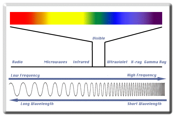
Maps are usually about vision - stuff in the environment we can see (on maps we can see), or invisible stuff mapped so it can be visible.
Tuan: "Blindness makes a geographical career virtually impossible, whereas it presents no insurmountable barrier to wisdom" (Sight and Pictures)
1b. Abstraction and Categories
Humans have the ability to think abstractly
Categories: a unit or a subunit of a larger whole made up of members sharing one or more characteristics
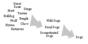
Common categories of human and environmental phenomena on maps:
Categories simplify our environment so we can understand it easily
1c. Symbols and Representation
Communication: We cannot always point to something when we want to communicate about it, so we need something to stand for these objects: symbols
Symbol: A thing representing something else because of relationship, association, convention, or resemblance.
Symbols for human and environmental phenomena on maps:
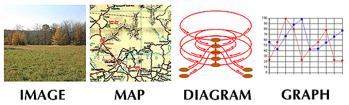
Visual Abstraction Gradient: the Visual Forms
Natural languages, maps, numbers, and words complement each other
Maps, as visual representations, and their symbols, are important as a means of
enhancing and speeding up our understanding of the environment around us
2. Visualizing the Human and Physical Environment
The way we envision or visualize the environment takes two general forms
1. intangible maps: representations of spatial relations in our head:
2. tangible maps: representations of spatial relations on paper or computer screens:
We will spend the majority of this class discussing cartographic maps, but will
start out with an introduction to mental maps
Next lecture: Psycho-Geographic & Mental Maps
E-mail: jbkrygier@owu.edu
...to Geog 222 Main Page and Course Description
...to krygier teaching page.
...to krygier top page.