Geography 222 The Power of Maps
...to Geog 222 Main Page and Course Description
...to Geog 222 Syllabus
...to Geog 222 Course Schedule and Lecture Outlines
...to Geog 222 Laboratory Information and Student Projects
Geog 222 Lecture Outline: Computers and Mapping
Update: 10/6/18
Introduction
Computers have had and continue to have a major impact on mapping
We can still make maps by hand...but
There is very little non-computer mapping anymore
- transforming the way we get the data to map
- transforming the way we design and produce maps
- transforming the kind of maps we can make
- transforming the way we use maps
A question to ponder: what is the future of the paper map?
Today and next few lectures: An Overview of Computers and Mapping
Computers and Mapping
Two very broad categories:
- Map Images
- Maps linked to Databases
Map Images
Map Images: a digital equivalent of a printed map
Maps connected to Databases:
- database: a store of information in digital form organized such that retrieval
can be done on a selective basis
Most common: a digital link between a spreadsheet/database and a digital map
- Spreadsheet/Database
- One column is geographic entity linked to the digital map: point (a well),
line (a road), area (a county)
- Other columns are attributes: county population 1910, 1920, 1930, etc.
- Convenient and efficient way to store and view and analyze
data with a spatial component
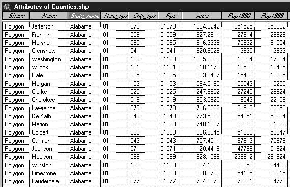
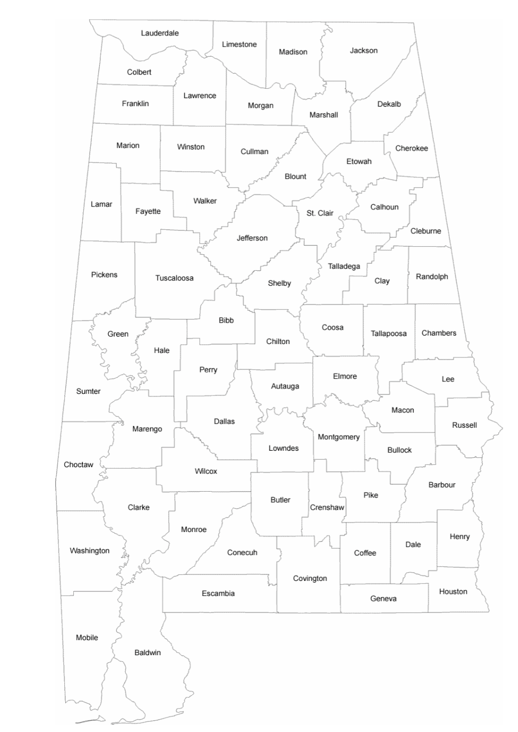
- Example: ArcGIS: digital 'connection' between map and data
- relational database: relate two data sets via common column of data
- FIPS codes
- unique geographical code (address) for geographic units (US and World)
- very important for Geographic Information Systems: GIS
Geographical Information Systems (GIS) and Geographic Information Science (GISci)
Pre-Computer GIS: The fundamental ideas behind GIS were established before computers
existed. Computers make GIS analysis much easier to perform, but GIS does not absolutely
require a computer
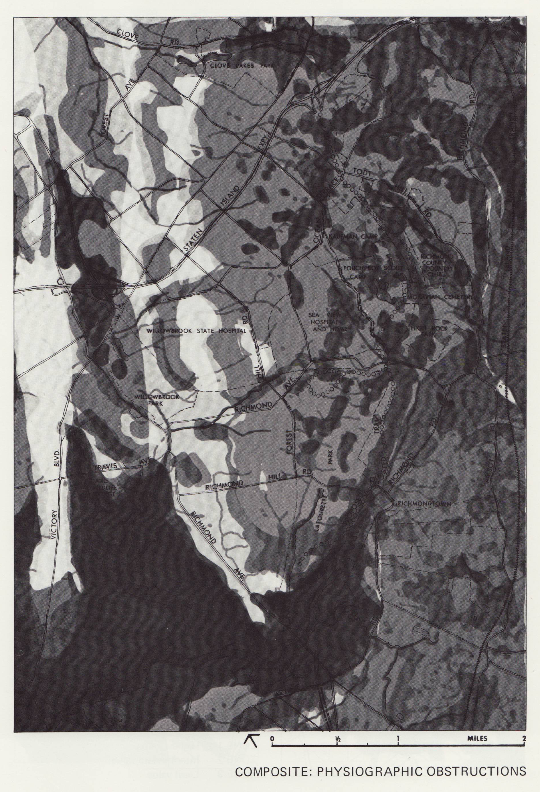
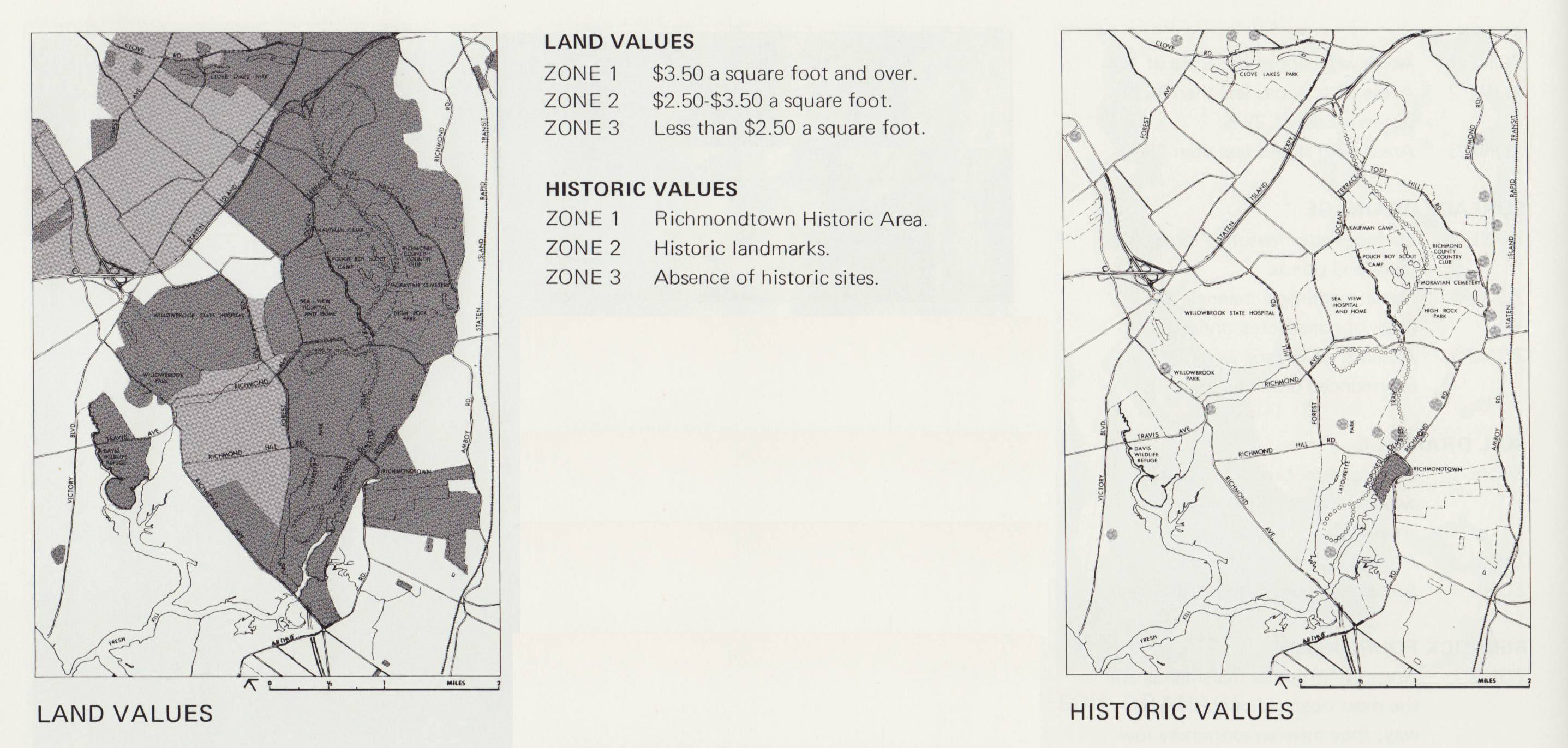
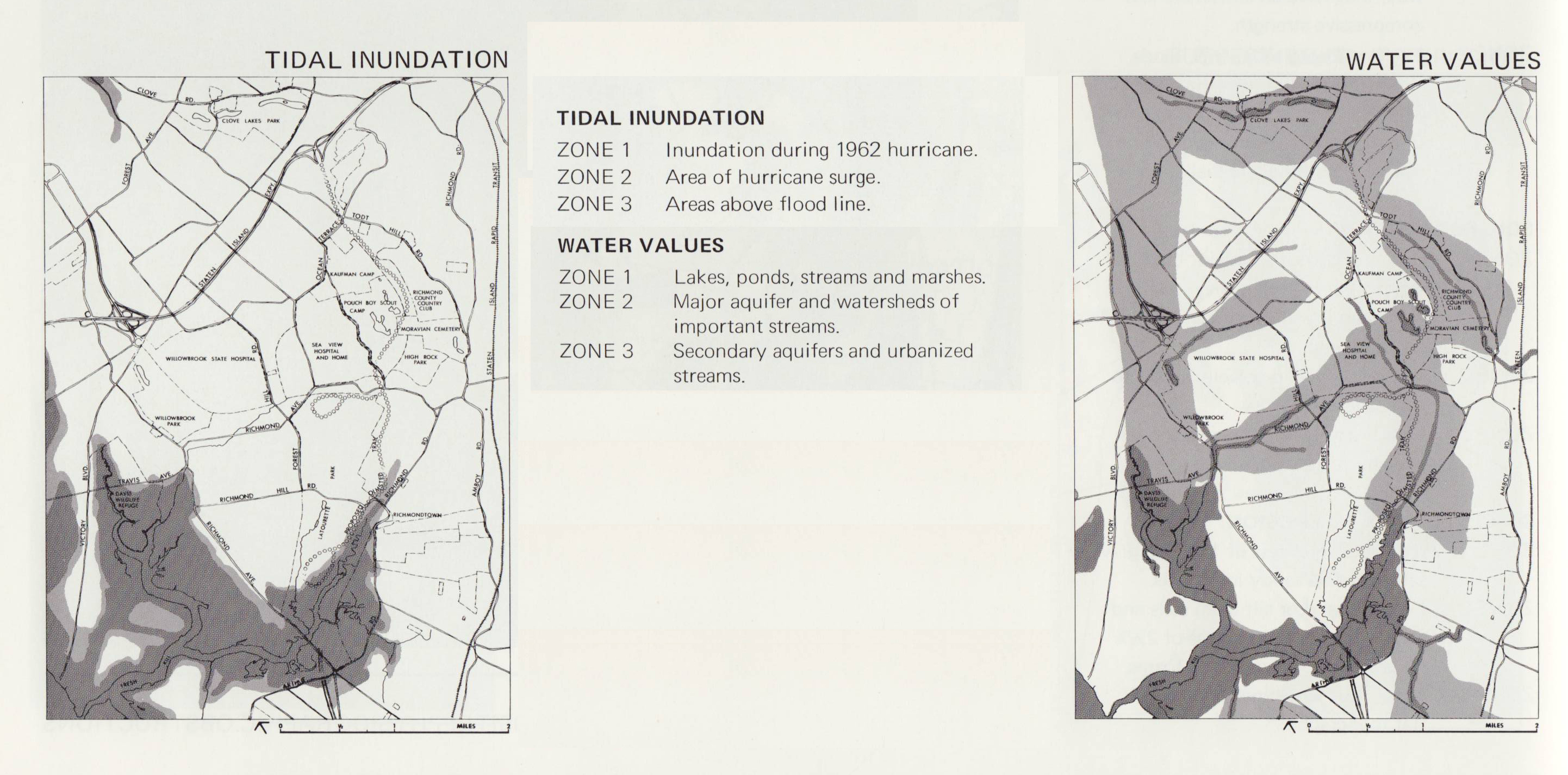
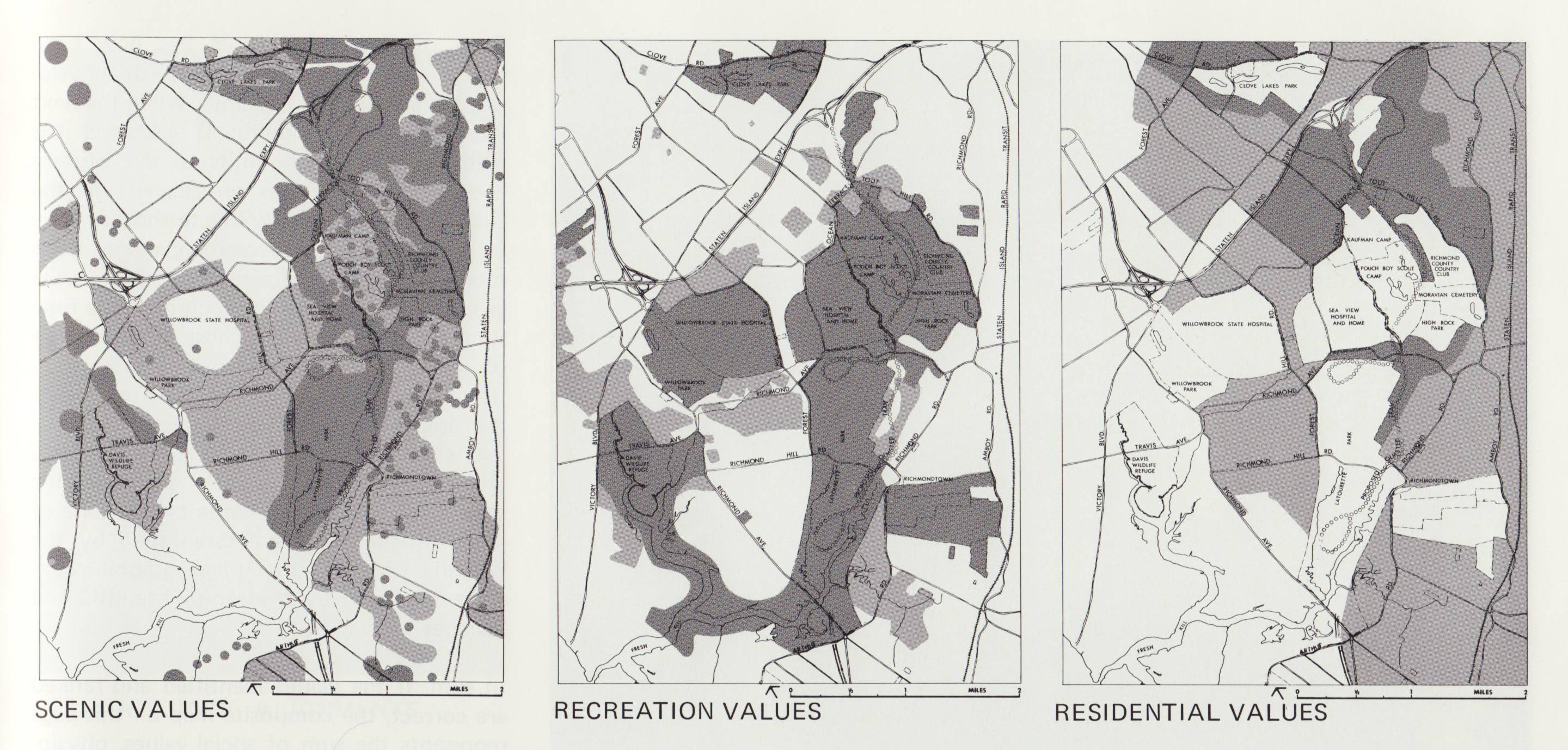
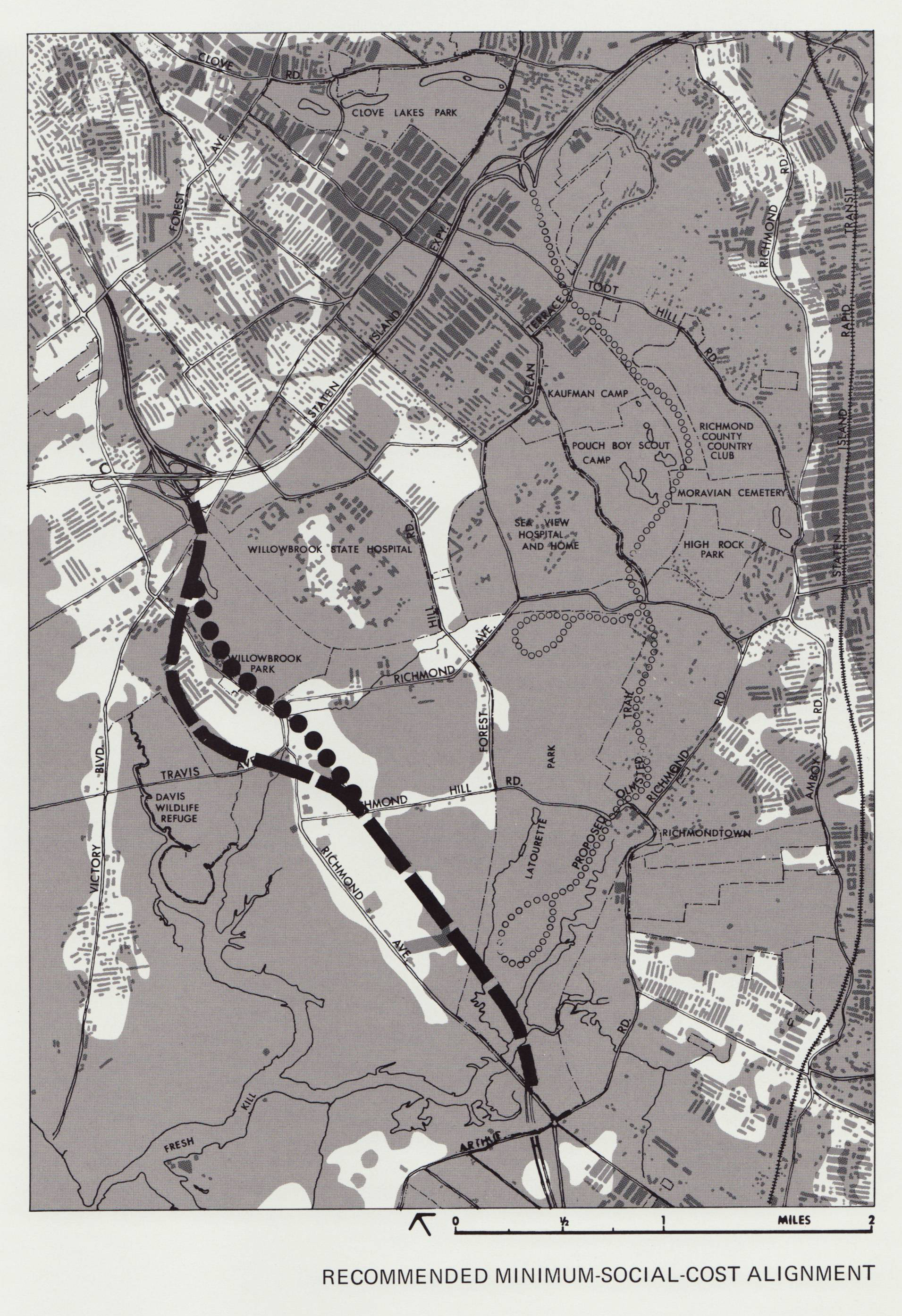
Classic example of pre-computer GIS: Ian McHarg: Using GIS to locate a new road (Design With Nature, 1969)
- compiling maps of various environmental factors (slope, drainage)
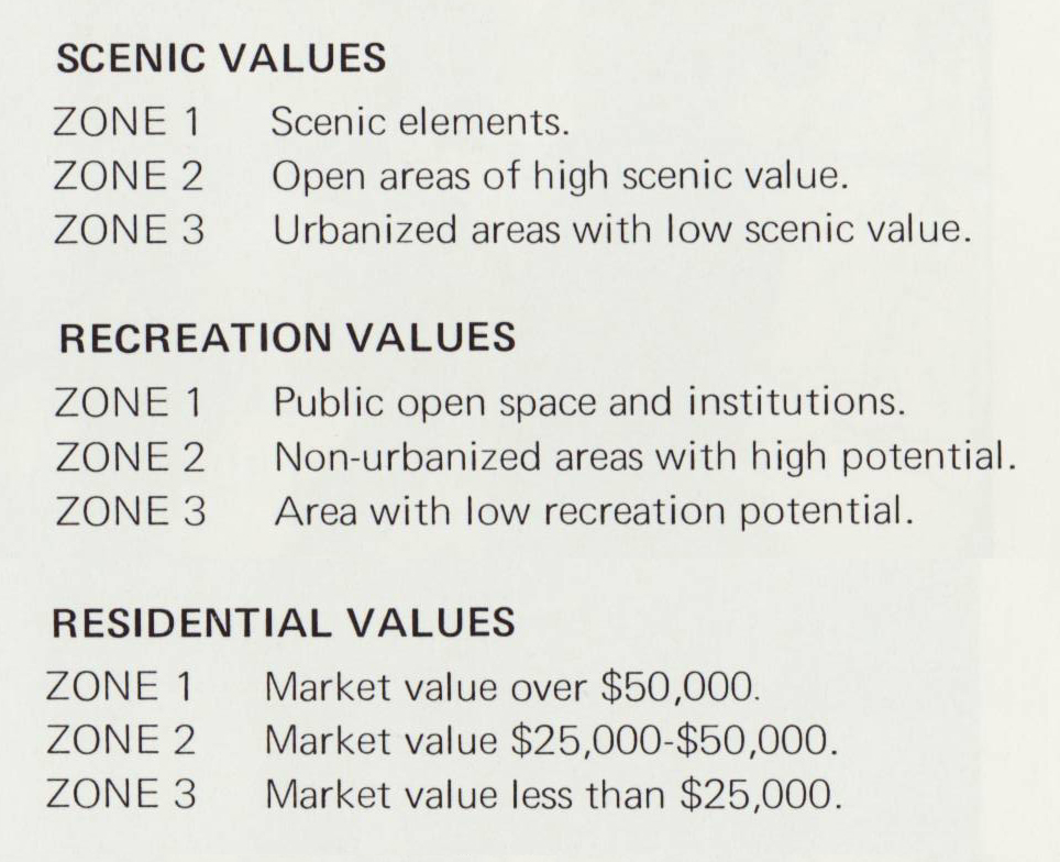
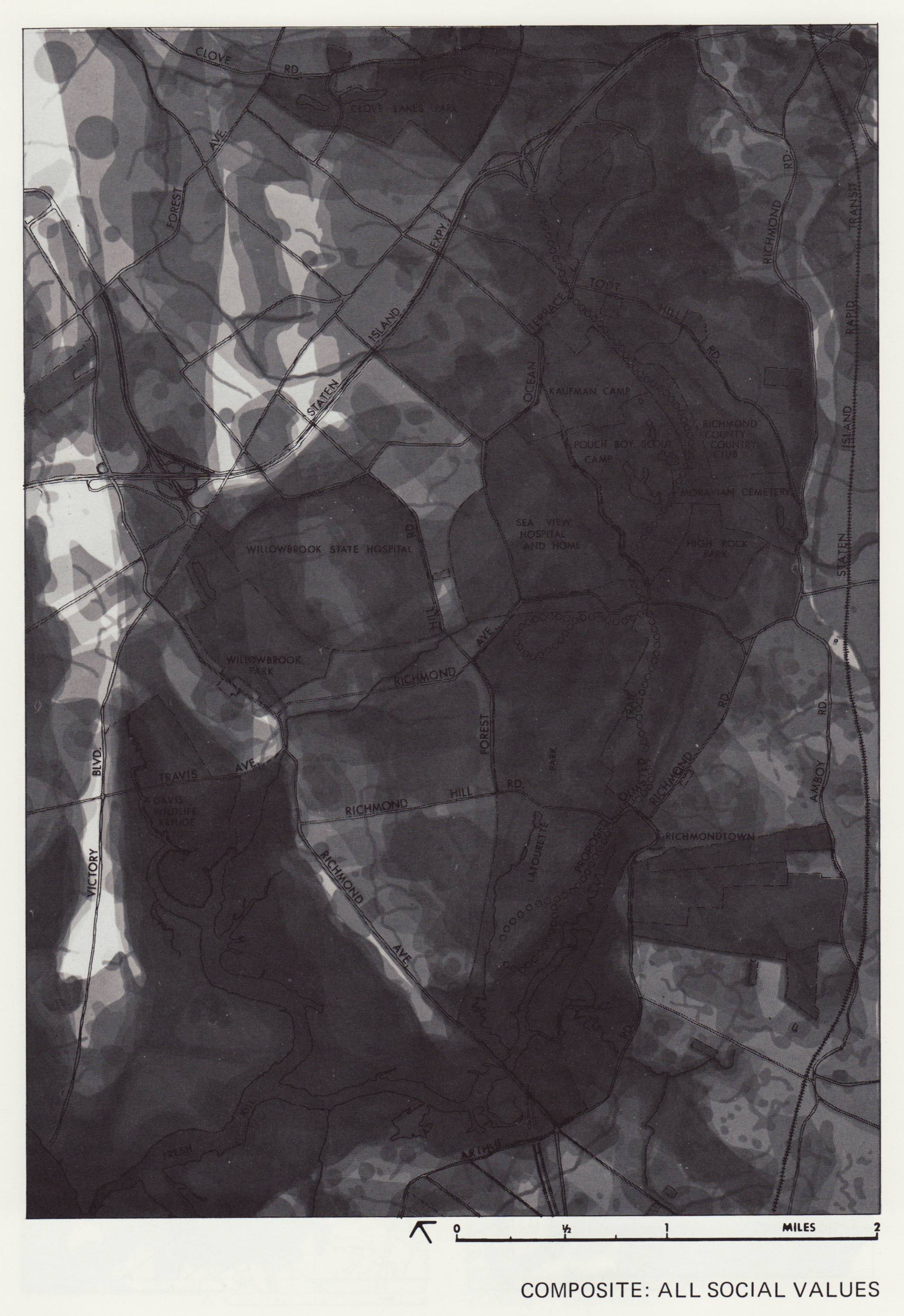
- key: dark areas = less appropriate, light areas = more appropriate
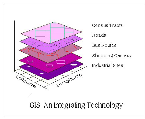
- idea of map layers: same area, different distribution of data
- idea of overlay: combining two or more coordinated map layers
- McHarg: Environmental Factors:
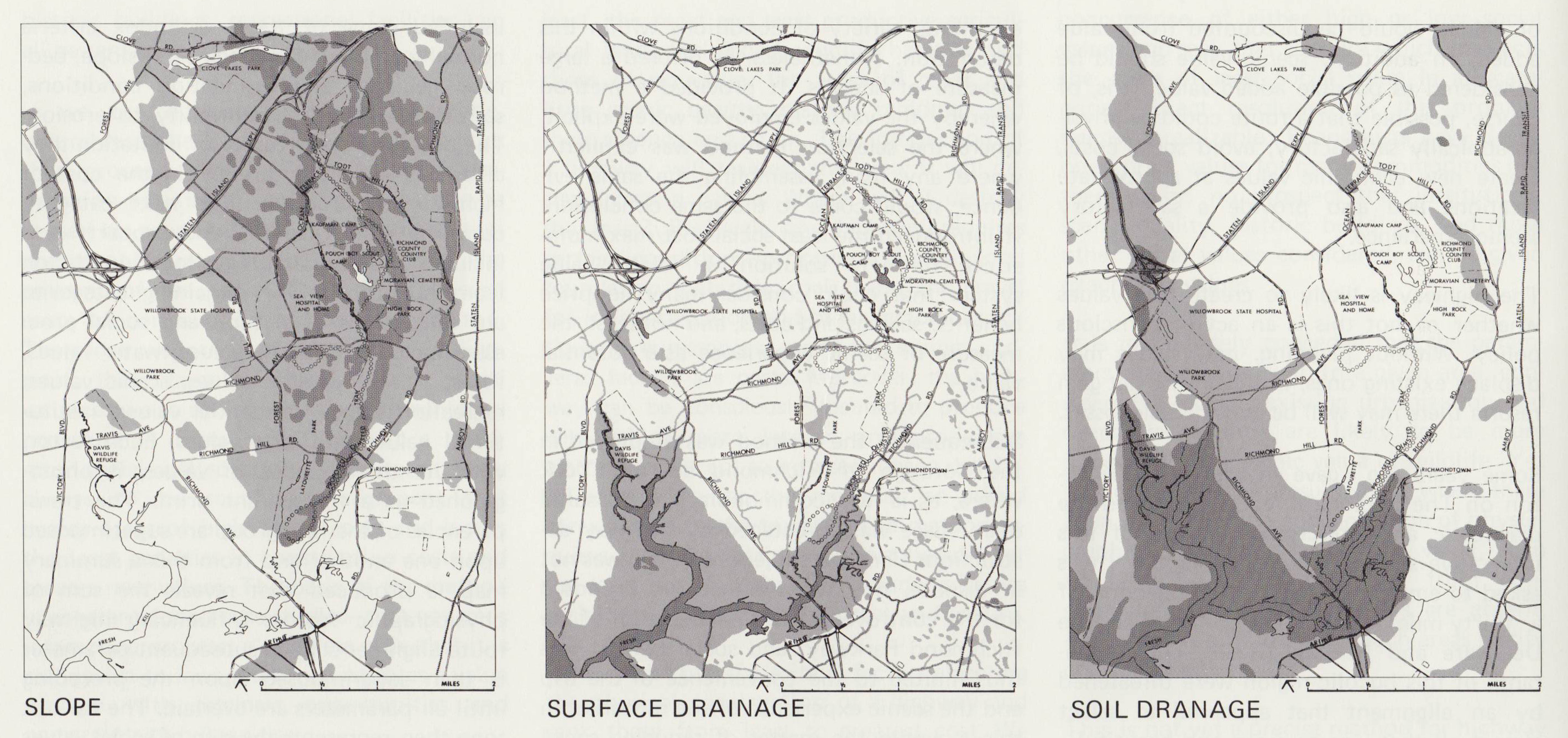
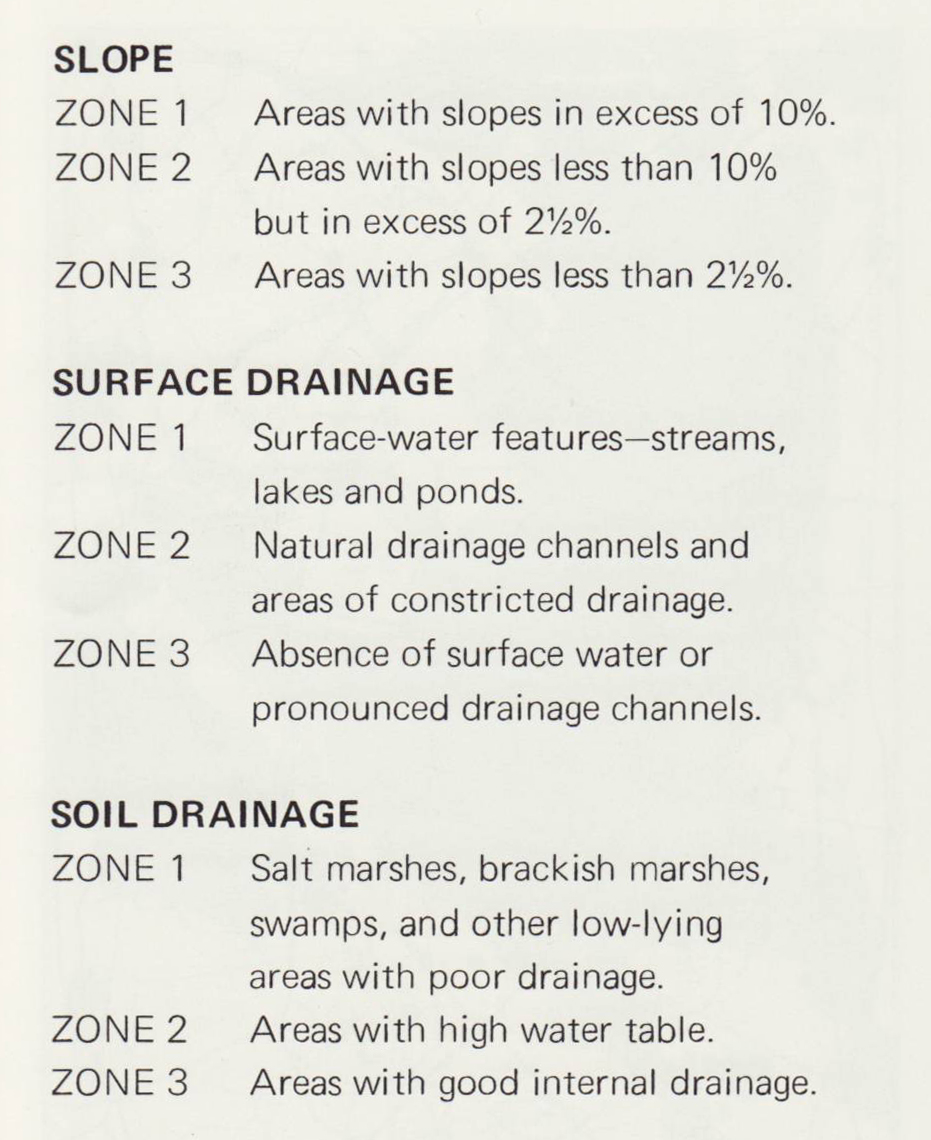
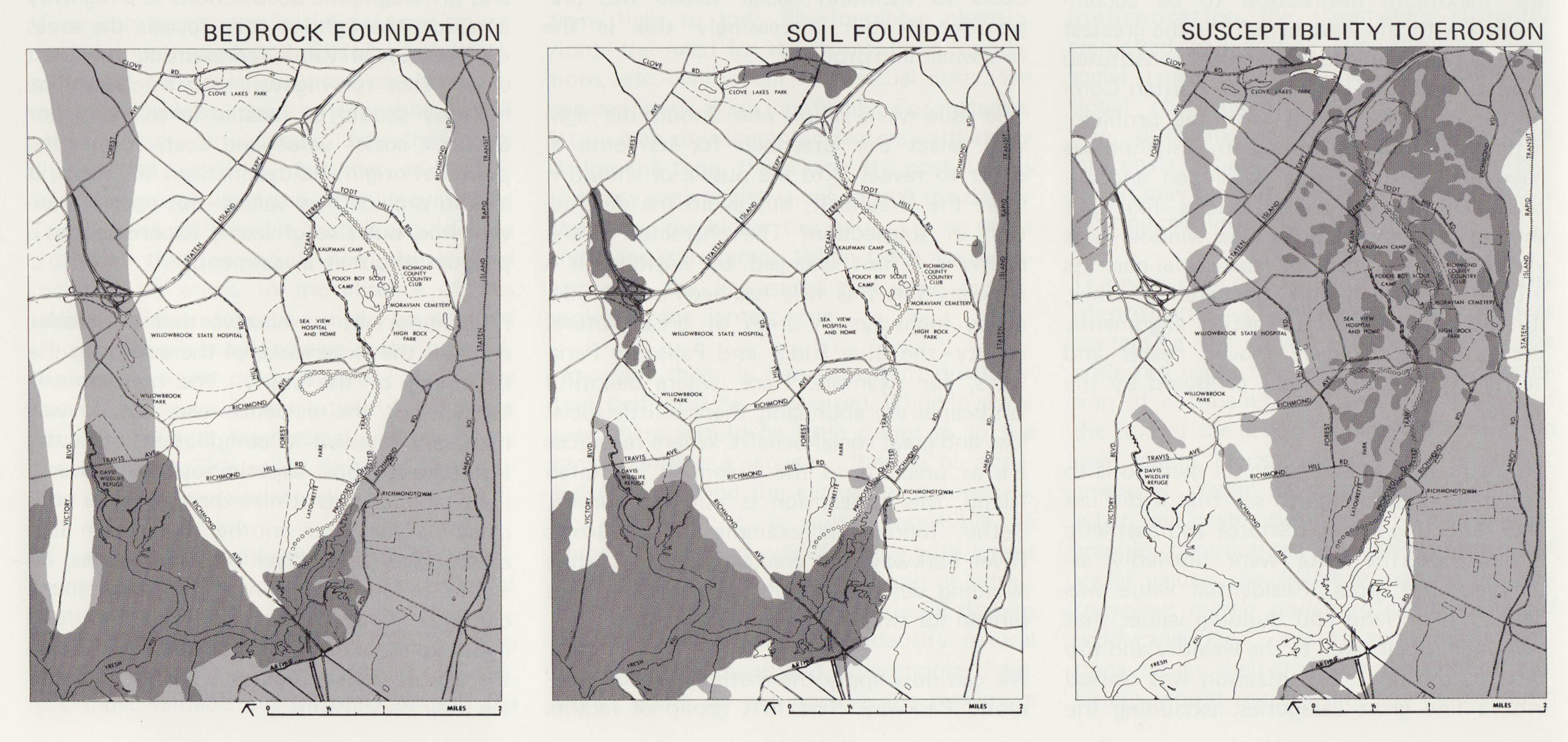
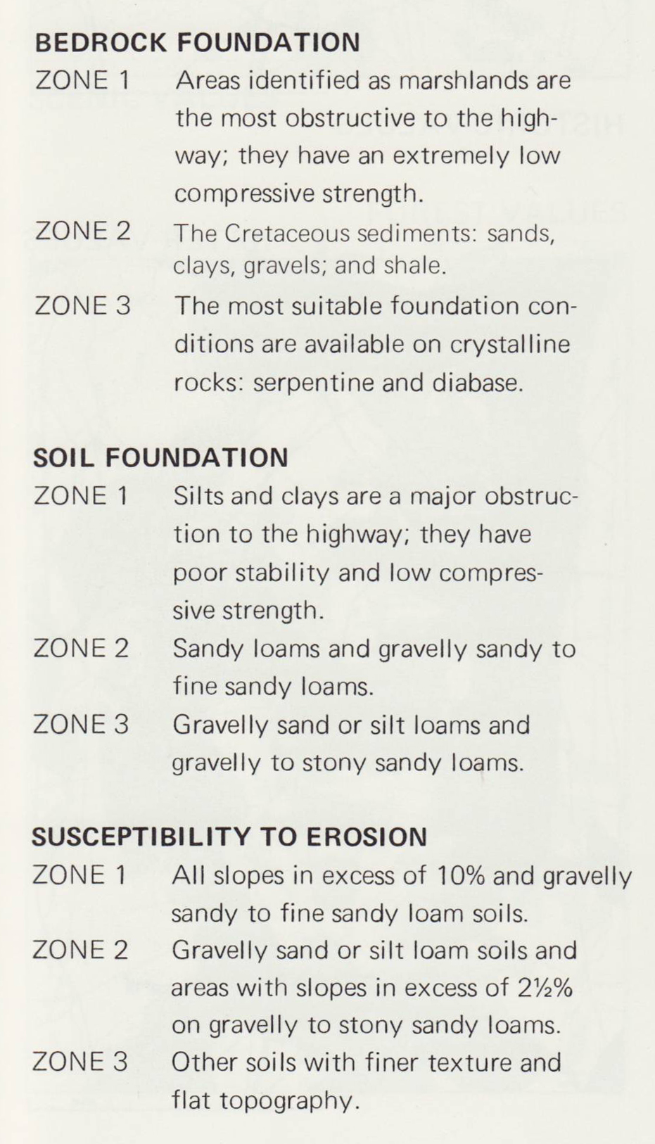
- McHarg: Environmental Factors Overlay
- McHarg: Social Factors
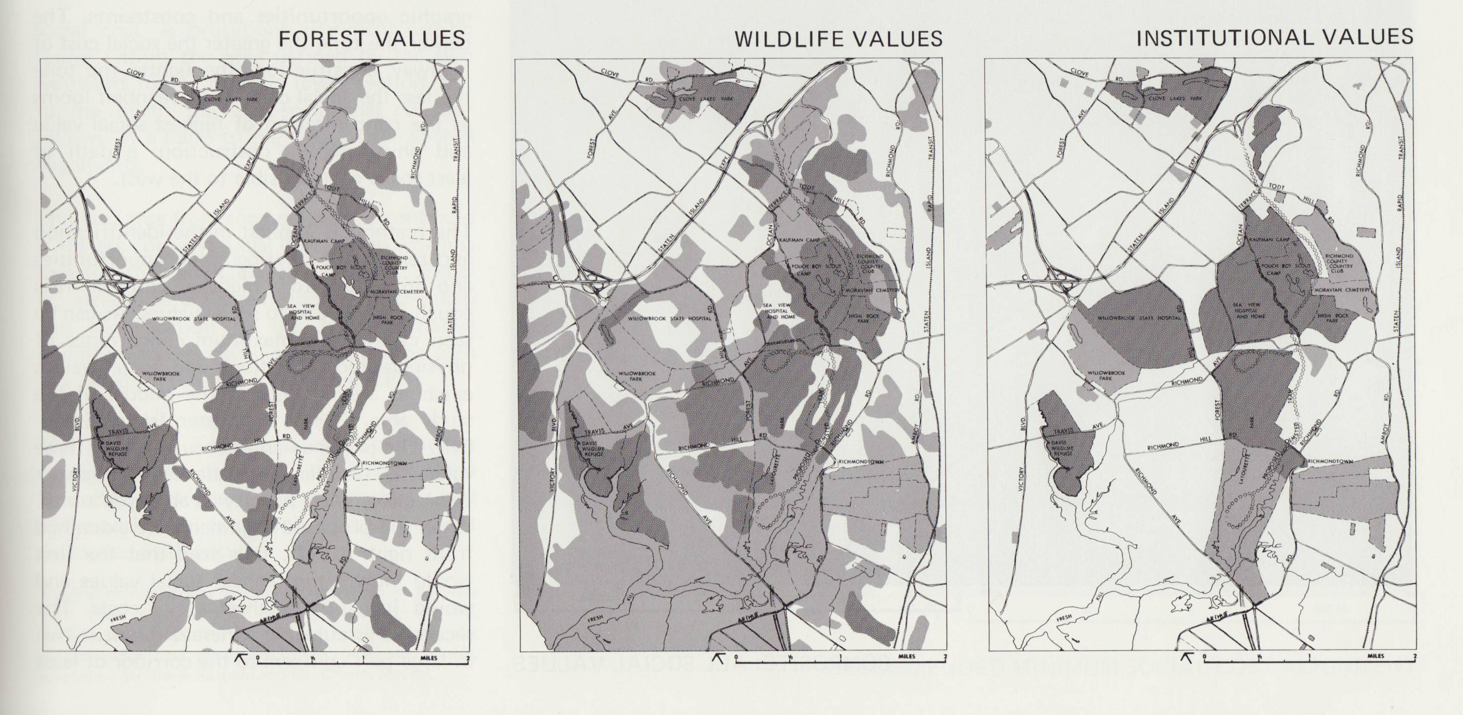
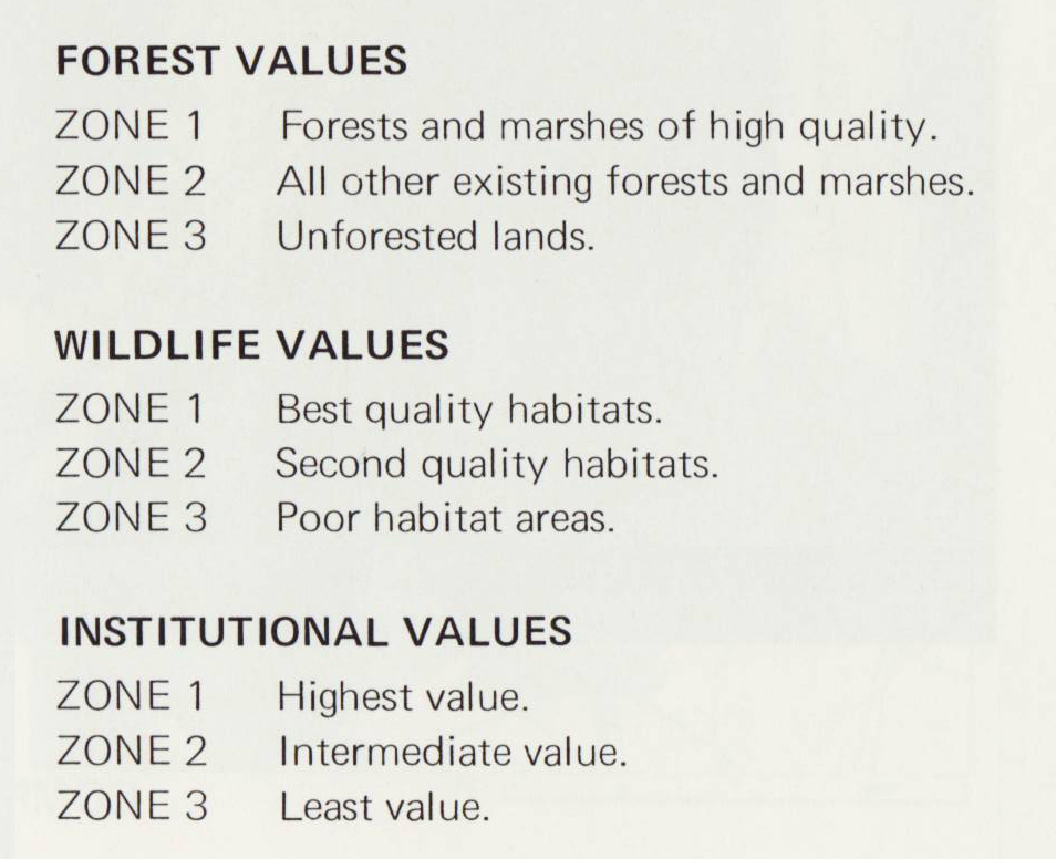
- McHarg: Social Factors Overlay
- McHarg: Environmental and Social Factors Overlay: Recommended Route
There is an important human and social component of GIS: it is not only
hardware, software, and concepts of spatial analysis.
- McHarg: Social Factors:


- Who decides these factors?
Defining GIS
GIS developed out of a diversity of software applications:
- land information systems
- computer aided drafting (CAD)
- computer aided mapping (CAM)
- geomatics
- databases
- data capture (digitizing, scanning)
- statistical analysis software
- spatial analysis software
- graphic design software
GIS is defined in two broad ways: GIS and GISci
1. GIS as geographic information systems (GIS) an integrative set of technologies:
combine the functions of the different software packages above into one package
- functions include:
- data capture: how do you get data in a digital format compatible
with the software?
- data analysis: spatial and statistical analysis of the data
- visualization/display: manipulating the data on a map on the screen
- output: designing the finished map at the end of a GIS project
- Multiple digital map layers, each linked to databases, aligned in a
particular geographic coordinate system (latitude/longitude)
- provides analytical functions: query, selection, buffer, intersect
- Example: overlay (locating a road example)
- Example: query
- Example: selection
- Example: buffer
- Example: intersect
- Technical characteristics and applications development of GIS
- The future: GIS on the Internet
2. GIS as geographic information science (GISci): the theories and concepts behind
geographic information systems
- theories and concepts from spatial analysis, cognitive studies of spatial
understanding, cartography and visualization, institutional or social context of
GIS use
- the intellectual characteristics and development of GIS
- WWW) Project Varenius: Research
in GIS
GIS Jargon:
- address matching: use spatial identifier (house address, parcel number, etc.) to link data to map
- metadata: data about data (describes who created data, when created, quality, use restrictions, etc.)
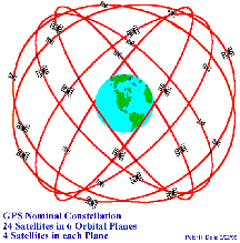
- Global Positioning Systems (GPS): satellite delivered data on locations/elevations
- GPS Benchmarks: accurate location/elevation monuments in environment based on GPS data; links to GIS maps
- coverage: a digital map layer in GIS
- geography: a digital map layer in GIS
- TIGER files: digital 'geography' or 'coverage' (map) from Census Bureau
- nodes: points located on a map layer in GIS
- attributes: data associated with a point, line, or area in a map layer in GIS
- identify function of GIS: point and click and get info from GIS database (access 'attributes' thru the
'coverage'/'geography' or, in english, the digital map layer
- query: more sophisticated request for information from GIS
- buffer: generate area around a point, line, or area for a sophisticated query (Meghan's Law)
A few things to keep in mind about GIS...
- GIS is more than just making maps
- GIS is developing rapidly, but still has difficult technological and conceptual
issues to tackle
- GIS come in differing levels of sophistication: ArcGIS vs Google Earth
- GIS functions are increasingly being developed for the internet
- Getting data into GIS is a huge undertaking
E-mail: jbkrygier@owu.edu
...to Geog 222 Main Page and Course Description
...to krygier teaching page.
...to krygier top page.
OWU Home
OWU Geology and Geography Home


